


Common Redpoll Irruption Update
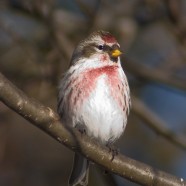
This is a companion blog entry to the Winter Bird Forecast by Audubon Connecticut and the Roger Tory Peterson Institute of Natural History. The first two forecasts were published recently: “Cloudy with a Chance of Snowys” and “Expect the Unexpected”. The third will be coming soon! The Common Redpoll (Acanthis flammea) was predicted to make a “moderate to good flight” this fall and winter due to “variably poor to average” birch seed crops in the boreal forest according to Ron Pittaway’s 2014-15 winter finch forecast. Nearly a month ago I started to notice more reports...
Read MoreHelp fill in eBird data gaps
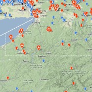
As we enter 2014 there is no better time than to declare yourself a citizen scientist for the New Year. Make the resolution now please and start your journey by eBirding all of your sightings on New Year’s Day and every day you can thereafter. For those who do not know eBird it is essentially a protected database of avian observations from around the world that is fully searchable by the public, completely free, and intended to last forever to be used by scientists anywhere on Earth. Our collective efforts help to fuel this conservation machine and their maps, graphs, and tables allow...
Read More