Hurricane Arthur
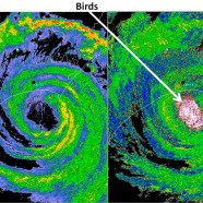
There always seems to be something strange going on with the weather in the Northeast United States and this Independence Day weekend was no exception. I cannot recall a time where we were even talking about tropical cyclones in early July but sure enough, Hurricane Arthur decided to make a close pass right off the Mid-Atlantic and New England coasts on the Fourth after ramming through the Carolinas. The most engrossing image I saw in the last week was this radar grab by the Severe Weather Institute – Radar & Lightning Laboratories at UAHuntsville. As they said it depicts the power...
Read MoreSpring avian migration continues
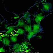
Hard to believe we’re in what should be the last week of heavy avian migration in the northeast. It is ON again tonight with birds moving around the storms continually being triggered in Western New York by a warm front. We’ll be out surveying across the area tomorrow.
Read MoreIrene and Sandy were teasers
This week marks the first anniversary of Hurricane/Superstorm Sandy, and we are now a little more than two years past Hurricane/Tropical Storm Irene. I know I am not the only person to see all of the recent Sandy articles, reports, television shows, and so forth. I am also not the only person disinterested in this almost celebratory atmosphere when it lacks a critical component – namely, that while both of these storms were strong and severe, producing fatal impacts and devastating lives, but they were soft punches and almost teasers for future more powerful tropical cyclones and other...
Read More


