Lark Sparrow (Chondestes grammacus)
This Lark Sparrow (Chondestes grammacus) is the one rarity Twan and I enjoyed in the post-Irene week that was likely not brought in by the tropical cyclone. You can find them rarely in the east during the late summer and early fall while our friends to the west enjoy these beautiful sparrows all summer.
Read MoreHurricane/Tropical Storm Irene Sooty Terns
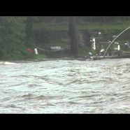
Three years ago tonight we in Connecticut and the tri-state area were recovering from the shock of being hammered by Hurricane/Tropical Storm Irene. She made landfall early on the 28th and I filmed these very rare Sooty Terns (Onychoprion fuscatus) she carried up from the topics as they made their way back down the Housatonic River, which separates Stratford and Milford, as the storm waned. As you can see the wind and water were still very turbulent! Most of us had damaged homes, yards and/or no power for several days and spent the next week seeing other unbelievably rare birds in our local...
Read MoreNew York state 24-hour precipitation record
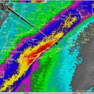
Unbelievable! A preliminary all-time New York state 24-hour precipitation record has been broken today at Islip MacArthur Airport with 13.26 inches of rain as of 9:30AM besting the previous record of 11.6 inches at Tannersville, New York over August 27-28, 2011 (Hurricane/Tropical Storm Irene). Here’s the dual-pol storm total estimated rainfall as of 8AM via NWS New York, NY. Remember again…turn around, don’t drown.
Read MoreSevere tornadic thunderstorm: six years later
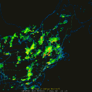
The best – or worst, however you’d like to classify it – thunderstorm I have ever directly been impacted by and experienced fully happened six years ago today on August 7, 2008. As a weather nerd I will never forget that date. As a human being who values his life I will always remember what it was like to feel a tiny taste of the true power of the atmosphere. I was living in Stratford, Connecticut, a coastal town, and after a relatively typical warm, humid August day we entered the evening as I kept an eye on a large cell moving very slow to the east/southeast further...
Read MoreHurricane Arthur
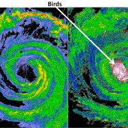
There always seems to be something strange going on with the weather in the Northeast United States and this Independence Day weekend was no exception. I cannot recall a time where we were even talking about tropical cyclones in early July but sure enough, Hurricane Arthur decided to make a close pass right off the Mid-Atlantic and New England coasts on the Fourth after ramming through the Carolinas. The most engrossing image I saw in the last week was this radar grab by the Severe Weather Institute – Radar & Lightning Laboratories at UAHuntsville. As they said it depicts the power...
Read More


